Rayalaseema is a geographic region in the Indian state of Andhra Pradesh. It comprises four southern districts of the state namely, Anantapur, Chittoor, Kadapa, and Kurnool.
1. Gandikota – Famous Tourist Place in Rayalaseema
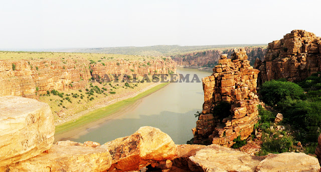
Gandikota is a small village in Kadapa district, on the banks of Penna river. The place is known as the Grand Canyon of India and is also equally significant as there are lots of structures belonging to several dynasties in this location.A village and historic fort located on the right bank of the Penna River, roughly 15 kilometers from Jammalamadugu in the Kadapa district, Andhra Pradesh, India, is called Gurukota. A number of dynasties ruled from the fort, including the Kalyani Chalukyas, Pemmasani Nayakas, and the Golconda Sultanate.
2.Lepakshi – Must visit places in Rayalseema
Lepakshi is a place famous for its elaborate sculptures, especially the large Nandi. All the sculptures are believed to have been done during the time of the Vijayanagara empire.
The city of Anantapur in Andhra Pradesh is an excellent example of the synthesis of the old world charm with the new age spirit. From places of historical interest such as the Penukonda and Rayadurga Forts to places of religious significance like Lepakshi.
Located in Lepakshi Mandal of Anantapur District, this village is located approximately 14 kilometers from Hindupur Town. During “SHIVARATHRI” and other Saivite festivals, this place is visited by a large number of pilgrims
Lord Veerabhadra Temple at Lepakshi, known throughout the world as one of the 108 Shiva temples of India, is one of the 108 Shiva temples in India. It is characteristic of Vijayanagara architecture. One hundred pillars support the Natya Mandapa dance hall, which is decorated with finely sculpted figurines depicting dancing gods. In the center of the room it rises twenty one feet, evoking the image of a giant lotus reaching toward the heavens. In addition to the statue of Veerabhadra carved in granite, the temple possesses carvings of the giant Naga Linga, the great bull, flying Gandharvas, Ganesh, etc.
Easy access to transportation:
In addition to being connected by rail and bus, Lepakshi is also served by air. Hindupur is the closest railway station. Tirupati and Bangalore are the closest airports

3.Nagalapuram – Tourist Place
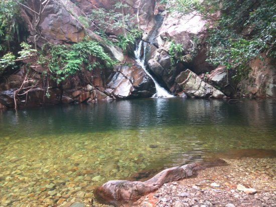
This village situated in Chittoor is home to a number of the most flawless waterfalls in the country and is a favorite of experienced enthusiasts. You can literally jump off of the cliffs into the water here.
4.Srisailam – Famous Temples in Rayalaseema
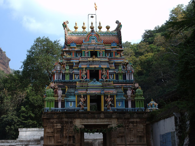
Srisailam is famous for its Mallikarjuna Swamy temple, which will be one of the 12 Jyotirlinga Temples dedicated to Lord Shiva.

5.Ahobilam -one of Famous Temple
Ahobilam was the place where Lord Narasimha murdered Hiranyakashipu. This is only one of the holiest places in Rayalaseema.
6.Talakona
Talakona Waterfall near Tirupati, is the highest waterfall in Andhra Pradesh, with a height of 270 feet. It is also home to several trek routes for adventure enthusiasts. Talakona is derived from two Telugu words, ‘tala’, which means head, and ‘kona’, which means hill. The magnificent and serene view of milky white streams of water falling from 270 feet puts one in awe of nature’s beauty. In addition to offering ideal scenery for photography and family gatherings, the falls receive their water from the Seshachalam Hills. It is believed that waterfalls are associated with a wide range of beliefs. Water that passes through various herbs and medicinal plants is widely believed to have therapeutic properties. Sri Venkateswara National Park is located near the waterfalls, where you can witness wildlife such as tiger, civet, jackal, spotted deer, ibex, sloth bear, bonnet monkey, among others.

7.Nalamalla Hills
Nallamalla range are part of the eastern ghats and are also home to a wide range of terrains. An individual can locate a different facet of character and can visit with the hills at Chittoor, Kadapa, and Kurnool.

8.Konda Reddy Fort – Tourist Place
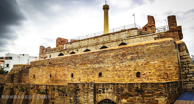
Konda Reddy Fort, aka, Konda Reddy Burj is a remnant of the Kurnool fort and is a must see when a person is in Kurnool city.This fort is located in the town of Kurnool in the state of Andhra Pradesh, India. It is also known as Kondareddy Buruju. An impressive structure located in the heart of Kurnool city, Konda Reddy Buruju is located 2 km from Kurnool Railway Station and 24 km from Alampur
The Story behind Kondareddy Burj , Kurnool -(Credits Quora)
It is believed that construction of the fort dates all the way back to the twelfth century when the city of Kurnool served as a stopover prior to the intersection of the Tungabhadra River. From 1530 to 1542, the Kurnool fort was built by the successor of Krishnadevaraya, Achyutaraya of Vijayanagara. Various passageways and strongholds are found within the fort. Gopal Raja, the grandson of Rama Raja of the Talikota Vijayanagara kings, developed the doors of the fort in the seventeenth century. This fort served as a watchtower during the seventeenth and eighteenth centuries.
Visitors may not visit the ground level, but can view the experiences on the first and second floors. With a large portico, there are few nooks on the first level. A large pinnacle is located on the second floor and is used for observation. In the seventeenth century, the Kurnool Nawab detained the last leader of Alampur in this fort, named after Konda Reddy.Despite escaping from the fort, Konda Reddy lost his territory to Golconda Nawabs.
Achyuta Devarayalu was approved to work on the construction of this structure, having a place in the Vijayanagar Empire, and it stands even today as the finest example of the design of the time. Located in Kurnool Fort, Konda Reddy Buruju is the only part of the fort that has been spared from being included in the heavenly site. During the reign of Konda Reddy Buruju, a jail was used as a sentinel. The Nawab of Kurnool reportedly detained Konda Reddy when he attempted to oppose him. The last ruler of Alampur, Konda Reddy (1597-1643), crushed Kurnool Nawab, who was an ally of the Golkonda Kings and a subordinate. An extended fight led to Konda Reddy being captured and detained by the police. Konda Reddy Buruju became known for his courage and dedication in combating the Muslim rulers. Through the excavation of a tunnel across the Krishna River, he was able to escape the post and lose his realm to the Golconda Kings.
9.Chandragiri Fort
Chandragiri fort is a historic fort in Chittoor, constructed in the 11th Century. The palace is an illustration of the architecture of Vijayanagar period.
In this fort are several of the important kavyas or epic poems that were written under the patronage of Vijayanagara kings and constructed in stone, brick, and lime mortar.[2] Inside the fort are eight temples, Raja Mahal, Rani Mahal and other ruined structures.[2] Inside the fort are Raja Mahal and Rani Mahal which are quite well maintained for more than 300 years and Raja Mahal is converted as Archeological Museum by Arechological Survey of India. The museum holds models of fort, main temple and other structures of surrounding area.[3] Both of these building were constructed without using wood and only lime, brick and morter was used. Rani Mahal has flat roof and at base level it has stable and epigraphical evidence says that this building was also used as commanders quarters.
The fort is the place where the pact of granting lands for Fort St. George to the British was signed by Vijayanagara King Sri Rangaraya during August 1639.
Various popular epic poems were composed in this fort under the patronage of vijayanagara kings and erected from stone, brick, and lime mortar. Within this fort are eight temples, Raja Mahal, Rani Mahal, and various other ruins. On the grounds of the fort are the Raja Mahal and Rani Mahal, which have been well preserved for more than 300 years and the Raja Mahal has been converted into an Archeological Museum by the Archeological Survey of India. Models of the fort, main temple and other structures associated with the area are on display in the museum. There were no wood used in the construction of either of these buildings and only lime, brick, and mortar were used instead. At the base of the building there is a stable and epigraphical evidence suggests that this building was also used by the commanders.
In August 1639, the Vijayanagara King Sri Rangaraya signed a pact to grant lands for Fort St. George to the British at the fort.

10.Tirumala
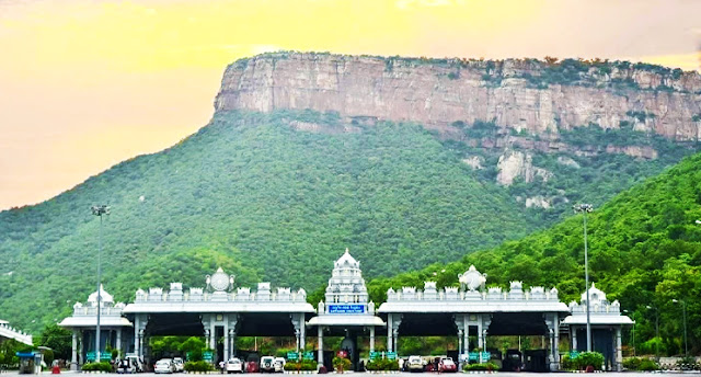
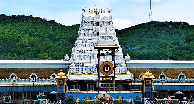
This list would be incomplete if this place isn’t mentioned. Tirumala hills are also home to a deer refuge waterfalls and much more and are home to the temple in India. Every Indian wants to visit one time to feel the holy spirit of Lord Venkateswara.
There are approximately 10.33 square miles (26.8 square kilometers) of land in Tirumala, which lies at a height of 3,200 feet (980 m) above sea level. A number of peaks surround the hills in the Seshachalam range, such as Seshadri, Neeladri, Garudadri, Anjanadri, Vrushabadri, Narayanadri and Venkatadri. On the seventh peak (Venkatadri), one can find the temple of Sri Venkateswara[6].
A significant stratigraphic discontinuity can be seen at 21 km along the Tirupati-Tirumala Ghat road which represents a period of remarkable peace in the earth’s geological history. Known as the Eparchaean Unconformity, this problem originated in the second century B.C.E. During the Eparchaean Unconfirmation, the Proterozoic Nagari Quartzite and the Archean granite were separated by a time gap of 800 Ma.[7] The Eparchaean Unconfirmity was considered a Geological Monument of India by the Geological Survey of India (GSI) in 2001.
